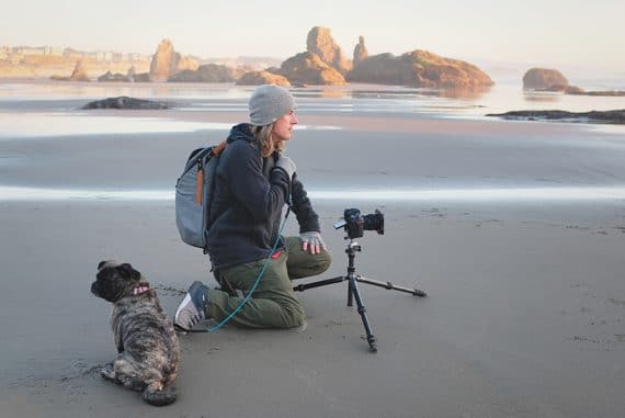
How to use the Photographer’s Ephemeris to Plan Outdoor Photography Shoots
Helpful beginners guide to using the Photographer's Ephemeris and why it's an essential tool for planning your next outdoor photography shoot in 2023.
By Greg Cromie
In this guide to using The Photographer’s Ephemeris (TPE), we’ll discover all the great features and benefits provided by this comprehensive software.
While TPE is available on desktop, we’ll be focusing on the smartphone app – chances are you’re more likely to use the mobile version while out in the field anyway.
(With the exception of Augmented Reality, most of the features actually work in the same way on desktop as they do in the app.)
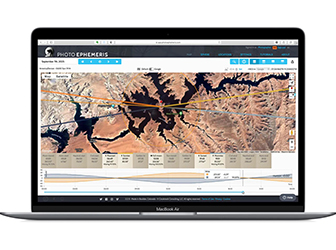

Useful and fun way to plan photo and video shoots, essential for anyone who takes pictures outdoors.
Get a 20% discount.
The Photographer’s Ephemeris is a one-stop solution that’s the ideal companion to any outdoor photography adventure – especially if you intend to shoot at night.
You’ll be able to plan and prepare for even the most challenging of shooting conditions.
If you want to photograph the next Supermoon, find out when a sunrise aligns with the city streets or need to know if buildings will block the sunset, TPE is for you.
Let’s take a closer look at all The Photographer’s Ephemeris has to offer.
(You should also read this article: how to find places to take pictures near me)
What is the Photographer’s Ephemeris (TPE)?
An ephemeris is a table of numbers that provides the accurate position of astronomical objects in the sky over a period of time.
The Photographer’s Ephemeris adds to this by providing both the data and visual guidance via Google Maps. As a result, you easily pin yourself in a location and utilise TPE’s data and maps to plan your shoot.
You’ll track the sunrise and sunset’s exact location and follow the Sun’s trajectory across the sky. You can do so in real-time or beforehand.
If you intend to plan ahead for a trip or outing with your camera, TPE allows you to set an exact date and time to determine lighting conditions.
What’s more, a handy timeline clearly shows you upcoming celestial events that include sunrise, sunset, astronomical twilight, golden hours, blue hour and moon phases.
TPE takes the complexity out of what’s essentially chart-plotting and navigation for photographers.
Aside from the smartphone app, there’s also a desktop/web app, with various features included in both the free and PRO versions.
Why use the Photographer’s Ephemeris?

By now, you may be thinking that The Photographer’s Ephemeris is a tool fit for landscape or astrophotographers.
It certainly adds a lot of value to the process of photographing those genres, but TPE is an excellent tool for anyone planning to take photographs with any amount of natural light.
If you’re a street photographer that loves using the city buildings to capture falling light (like Stonehenge), TPE is for you. Plus, the app provides real-time tracking of the Sun’s motion and upcoming events such as the golden hour and blue hour.
With this data, you can plan your street shoot to ensure that you’re on the streets and travelling in the right direction to capture perfect lighting.
For wedding photographers planning the big day, TPE provides necessary information on the conditions of a location that you intend to use as a backdrop. You can prepare for the changing light of the day and know which direction to face for the best lighting conditions.
The Photographer’s Ephemeris streamlines the research and planning stage to grant more time to focus on capturing stunning images.
Main Interface of The Photographer’s Ephemeris

Upon first glance, the user interface of The Photographers Ephemeris appears a little cluttered and complicated.
That’s because there’s a lot of information and options crammed into your smartphone screen. Keep in mind that this isn’t a typical photo app that allows you to apply filters or cute image overlays.
Rather, TPE is a serious photography companion that provides up to date and accurate scientific information on a range of critical elements.
Once you get past the initial set-up permissions from your smartphone, it all becomes clear.
Upon closer inspection and taking a few minutes to understand what you’re looking at, the app is broken into a few key areas.
The app’s top bar provides date, time, timezone, and accurate positioning of longitude and latitude. You can flip forward and back with the date, and there’s also an icon to share your current position via email and social platforms.
The screen’s centre is where all the action happens – TPE uses Google Maps as the base layer with critical information overlayed.
With a location pinned, four coloured lines project away from the pin to represent Sunrise, Sunset, Moonrise, and Moonset’s exact direction.
At the bottom of the screen, on a scrolling menu, there are several data-tiles, with each representing data from the ephemeris.
These tiles include Moonset, Nautical Twilight Start, Civil Twilight Start, Sunrise, Moonrise, Sunset, Civil Twilight End and Nautical Twilight End.
You can also add custom settings that include other celestial events such as Astro Start and Nautical Start.
Each tile can be tapped once to bring up elevation profile information. Tap twice to open up a menu of customised options depending on your shooting scenario.
Below that is a scrolling graph showing a day’s timeline with the Sunrise and Moonrise arcs throughout the day. As you scroll through this timeline, the four lines representing the direction and path of the Sun and moon shift in unison.
Finally, the bottom menu bar features five icons for Map, AR, Locations, Visual Search and More. The More menu allows you to change settings, set up an account and more.
How to use Photographer’s Ephemeris
The best way to understand how to use The Photographer’s Ephemeris is to download it and have a play… but that would defeat this article’s purpose and put me out of a job – we don’t want that!
For the sake of this article, the best way to describe the use of TPE is with a real-world scenario. That way, you can see the power and brilliance of it in action in real-time and as a means of planning a photography event.
Before we get to that, let’s take a closer look at how each of its functions supports outdoor photography with natural light.
1. Use Maps To Set A Location

As mentioned earlier, the main element of The Photographer’s Ephemeris is the map. TPE uses accurate data from Google Maps as the central platform for the app’s functions.
It’s a lot like looking at Google Maps on your phone except that there are lines drawn across it… but for us photographers, those lines point to the most essential things – natural sources of light.
Provided you’ve agreed for the app to use your current location, the pin automatically drops right where you stand. From that pin, four lines extend outwards to show the direction of Sunrise (orange), Sunset (yellow), Moonrise (light blue) and Moonset (dark blue).
By tapping an icon, you can turn on Track Heading and place your pin at a nearby location. That way, you can view what the changing conditions of those four lines of light will be as you move towards your pin.
Plus, the app shows you the Geodetics of your journey – the elevation changes along the way. Geodetics actually relates to Geodesy which is the science of accurately measuring the Earth’s geometric shape and orientation in space.
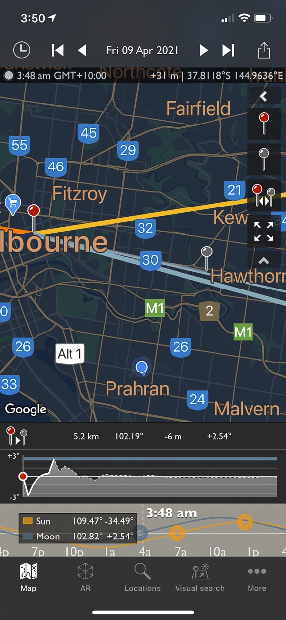
By harnessing Google Maps’ full power, you have access to a broad range of map styles.
Aside from the usual Google Maps that we use to navigate journeys, TPE uses the Google Hybrid map view that incorporates satellite images with crucial information overlaid. In addition, Google Terrain maps show the lay of the land with elevated areas clearly represented.
The Open Street Map removes all buildings found in the Standard Maps and gives you a straightforward and easy to follow map.
Finally, as with any Google Map application, you can search for a destination. Using the Locations tab, you search for an address or place by name.
Plus, if you’re super nerdy, you can search for coordinates of a location. Either way, you can view the site on the map, pin it and save it for later.
As with your current location, any searched location shows the Sunrise, Sunset, Moonrise and Moonset.
2. Augmented Reality

The first time I tapped the Augmented Reality (AR) icon, I was blown away! The Photographer’s Ephemeris uses the gyroscope, compass and camera of your smartphone to create an immersive AR projection.
Holding your smartphone upright, you have an accurate world view with several graphic overlays.
The compass is incredibly detailed and accurate and is represented on the screen with vertical lines at East, South East, South, etc. There’s also a scrolling bar that shows the compass direction and also a horizon gauge to the side.
Several horizontal lines represent the Moonset, Civil Twilight Start, Sunrise, Horizon, Moonrise, Sunset and Civil Twilight End.
Two arcing lines, one to track the path of the Sun and the other to follow the course of the moon, allow photographers to accurately predict how these light sources will influence their final image.
These pathways are also represented along the bottom with the same timeline as shown on the Map tab.
At night, there’s a ghosted overlay of the moon and star constellations in the sky.
If you need to set up for a landscape shot or want to shoot the sunrise, sunset or the moon, the AR function is ideal. It allows you to position yourself in the scene, and by panning the horizon with your smartphone, you see exactly where everything is going to happen before it happens.
Plus, you can do so for any given date or time by simply sliding the timeline back and forward!
I would imagine that the AR function of TPE will chew through the battery faster than the other modes, so ensure your smartphone is charged-up or you have a portable power bank.
Unfortunately, I can’t show you Augmented Reality in action while in my favourite location – out on the street in Shibuya, Tokyo, so you’ll have to settle for South Yarra, Victoria.
3. Use TPE To Set A Future Date

One of The Photographer’s Ephemeris’s best features is the ability to time travel – or set a future date.
Regardless of your being at home or some far-reaching corner of the globe, you can place yourself there with the map. What’s more, you set the date and time to view the direction of the Sun and Moon as well as a range of other data, including light pollution, star overlays and celestial events.
You can shift the date back and forward single days or in more significant jumps. Or, tap on the date to open up a window to set a future or past date. Time travel!
TPE also displays all significant celestial events scheduled for the remainder of the calendar year. This includes moon phases, lunar and solar eclipses, Solstice and meteor showers.
If you intend to travel to a location and shoot astrophotography, the moon or a freaking meteor shower – you know exactly where and when it will occur!
4. Make the Most Of Night Modes

The Photographer’s Ephemeris serves several purposes for photographers. It allows us to pinpoint current and intended locations and know where the Sun will rise and set on any given date.
Capturing either event is just as important as harnessing the Sun’s light during the day for many genres.
If shooting landscapes, TPE helps to show where the Sun will travel across the sky so that you don’t face the wrong direction when composing your shot.
If you’re a wedding photographer, you can know precisely where the Sun will be at the time of your outdoor portrait shoot. That way, you can position yourself and the bridal party to suit the lighting conditions.
TPE is not just for daytime shooting. One of the most significant advantages of an app like this is the ability to track celestial events at night.
Another great feature of The Photographer’s Ephemeris app is selecting two-night modes in maps.
The first night mode is a light pollution filter that shows the density of light and dark areas. When shooting astrophotography of any nature, the first rule is to avoid light pollution. Light pollution is caused by streetlight, house lights, traffic, shopping centres and building.
Basically, shooting in a built-up or urban area won’t yield the best results due to light pollution. Avoiding it and shooting in pure darkness is the best way to make the most of an astrophotography shoot.
The second night mode is a Star Overlay that shows the star constellations in the night sky – make TPE perfect for astrophotographers. There’s even a star overlay in the Augmented Reality mode of TPE.
If you intend to shoot astrophotography at your current or a distant location, you can plan for the event and know the level of light pollution plus the directions to face for constellations.
For a comprehensive guide to astrophotography, check out our article here.
5. Photograph The Sun & Moon

The Photographer’s Ephemeris provides easy and accurate tracking of the Sun and the moon. What’s more, it does so at any time of the day and at any time of the year.
As soon as you open TPE, it provides you with a set of four lines to show you the direction of the Sun and the moon.
Starting with the Sun, an orange line shows where the Sun rises at the horizon line. A yellow line shows where the Sun will set at the horizon.
If you’re keen to know where and when the Sun will rise in greater detail, the Sunrise tile shows the time of sunrise and its bearing in degrees. Tap on this tile to select one of three Elevation Profiles ranging from 1.8km to 15km. A Geodetics graph will appear and show the elevation and line of sight between you and the horizon line.
As a result, you can tell if your current location is suited to capturing a sunrise or sunset and if there will be any obstructions.
The Photographer’s Ephemeris also pulls data from Google on buildings that may obstruct celestial events.
The same sight line function can be applied to Sunrise, Sunset, Moonrise and Moonset. When you are in Augmented Reality mode, the rise and set lines are clearly marked as are the trajectory of the Sun and Moon.
6. Blue Hour & Golden Hour

Landscape photographers love the quality of light during Blue Hour and Golden Hour.
Fortunately, The Photographer’s Ephemeris provides accurate data on those times throughout the day – plus, you can plan for these times at a later date or different destination.
When using the Map mode, the four key lines to show the rise and setting of the moon and Sun are constant. These are also represented with the scrolling tiles at the bottom of the map, and there are also additional tiles to represent other celestial events.
Civil Twilight Start occurs before sunrise when the Sun is still below the horizon – it’s what we otherwise refer to as the morning Blue Hour.
The morning Golden Hour lasts between sunrise and about an hour afterwards. At the other end of the day, the same occurs.
The afternoon Golden Hour is the hour before Sunset and the afternoon Blue Hour lasts until Civil Twilight End.
Fortunately, TPE provides clear information on each of these events, including time and duration.
7. Use Visual Search
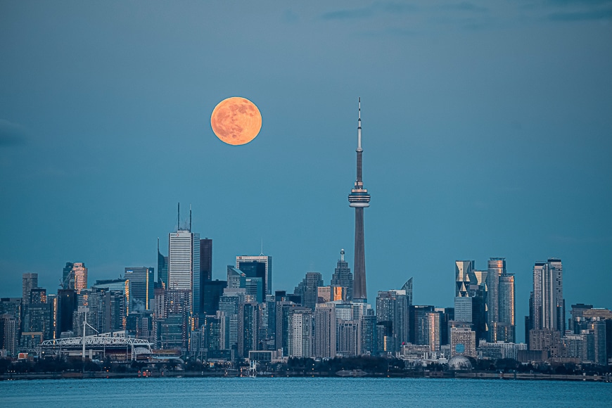
The Visual Search option within The Photographer’s Ephemeris is a handy way to plan a creative shoot to capture a celestial event. It’s a search function within the app that requires you to enter the Sun or Moon’s Azimuth and Altitude.
The Azimuth is the horizontal angle or direction of a compass bearing – in other words, which way to face. And altitude is how high to look up.
While this sounds crazy-technical, there’s a method to this madness.
Let’s say you love to shoot landscape photography, and there’s a brilliant location you have in mind. This location has a massive outcropping of rock, and you want to photography it when the Sun is in just the right place.

With Visual Search, you can enter the Azimuth and Altitude of your location, and TPE will provide the exact data for that event.
The same applies to wanting to capture the next full moon over a site you intend to shoot.
If you want more help with setting a Visual Search, just enable Geodetics on the map first and use the secondary map pin to locate the object you intend to shoot.
TPE will then auto-fill the Visual Search function location and provide you with the date, time, and line of sight for your desired celestial event.
8. TPE Advanced Options
It’s worth pointing out that if you intend to get a good bang for your buck with TPE, there are a few Advanced options available.
The first is to manage Shadows by evaluating the length of the Solar and Lunar Shadows.
The Photographer’s Ephemeris calculates the shadow length when you manually enter the approximate height of a nearby object at a particular time of day.
You also use the Elevation Adjustment setting to enter a secondary object’s height that will also cast shadows.
The Photographer’s Ephemeris allows the Elevation at Horizon to be manually configured to override the automatic setting.
This is a little tricky to calculate manually, and I would recommend sticking with the auto settings for the best outcomes.
9. Skyfire Subscription
The Photographer’s Ephemeris also offers an add-on subscription service called Skyfire.
This uses all the existing TPE and Google Maps features and provides various overlays to provide the best forecast of lighting conditions on the date you wish to shoot.
However, this goes beyond what we’ve described here about TPE. Skyfire provides sunrise and sunset colour forecasts to help you select the best time and location for a shoot.
The information is represented as a colour overlay across the map and can be forecasted for up to four days ahead. If you love capturing stunning landscape shots with dramatic colours in the sky, Skyfire is a worthy addition.
Using The Photographer’s Ephemeris In The Real World

Tokyo from the Tokyo Skytree observation floor at 350m high.
As promised, let’s plan an event using The Photographer’s Ephemeris to display how it works.
In the following example, I’ll plan a photography trip to Tokyo at a future point in 2021. (This is wishful thinking as I actually want to be in Tokyo at a future point this year!)
Let’s head to Tokyo, where I want to capture the sunrise from the top of the Tokyo Skytree.
The Tokyo Skytree sits 634m tall, making it the tallest building in Japan and the second tallest in the world. The tower is located in Sumida – just across the river from Asakusa.
As you can imagine, from that height you can see for miles.
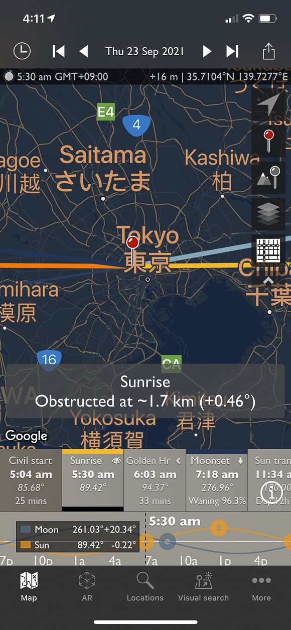
I intend to be in Tokyo and up in the higher observation tower of the Tokyo Skytree on 23 September 2021. Using The Photographer’s Ephemeris, I can perform a search for this specific location.
The date and time will default to today, so I enter 23 September 2021 and hit Done. The map instantly loads – so fast with Google Maps – and the pin is dropped on the exact location of Tokyo Skytree.
Thanks to the tiles showing the various celestial events, I know the following:
- Civil Twilight (Blue Hour) starts at 5:04 am
- Sunrise occurs at 5:29 am (yellow line)
- Golden Hours occurs until 6:03 am
- The Moon sets at 7:18 am (light blue line)- bonus capture as the moon is in the same direction as the sun.
- I can get coffee, east Sushi, do some street photography and eat Ramen until Golden Hour
- Golden Hour begins again at 5:37 pm
- Sunset occurs at 5:37 pm (orange line)
- Civil Twilight (Blue Hour) starts again at 6:02 pm
- Moonrise takes place at 6:58 pm (dark blue line)
- Thanks to the lines of sight on the app, I know which direction to face when the Sun rises in the East.
- I can scroll the timeline at the bottom and see what changes throughout the day.
- While there, I can use the AR function to check where the sun will rise and where it will travel.
As a result of using TPE, you can plan your holiday or photography trip well before your departure date.
In fact, you can plan years ahead and know that unless there’s some large-scale-Avengers-like-catastrophe, the Moon and Sun will be exactly where The Photographer’s Ephemeris said it would be.
Final Words
There’s a massive list of photography and videography related apps available on both iOS and Android devices – plus those that also work on Desktop. We’ve even covered many of them here on Shotkit.
Some are useful but mostly fun editing apps, such as those that turn photos into paintings or apply filters. Others are more powerful tools designed to provide a complete photo editing solution for those on the move.
Then, there are apps that work as an information service to help you plan your outdoor photography projects. Some cover just one element of information required for your next event while others are more comprehensive.
The Photographer’s Ephemeris is one of the most well thought out apps suited to any photographer. It’s a clever meshing of the advanced tech available within your smartphone, the power of Google Maps, and actual scientific data on how the Earth moves through the solar system.
Regardless of the photography genre, you want to master, TPE is for you. If you have a need for natural light or wish to master celestial event photography, it’s quite simply the ideal app.
What are your thoughts on using TPE for outdoor photography? Have you had experience with this app or any other app of this nature?
Feel free to join the conversation and ask questions about celestial photography, chasing light or just using The Photographer’s Ephemeris.


Useful and fun way to plan photo and video shoots, essential for anyone who takes pictures outdoors.
Get a 20% discount.


Check out these 8 essential tools to help you succeed as a professional photographer.
Includes limited-time discounts.


